Course Details
Course Overview
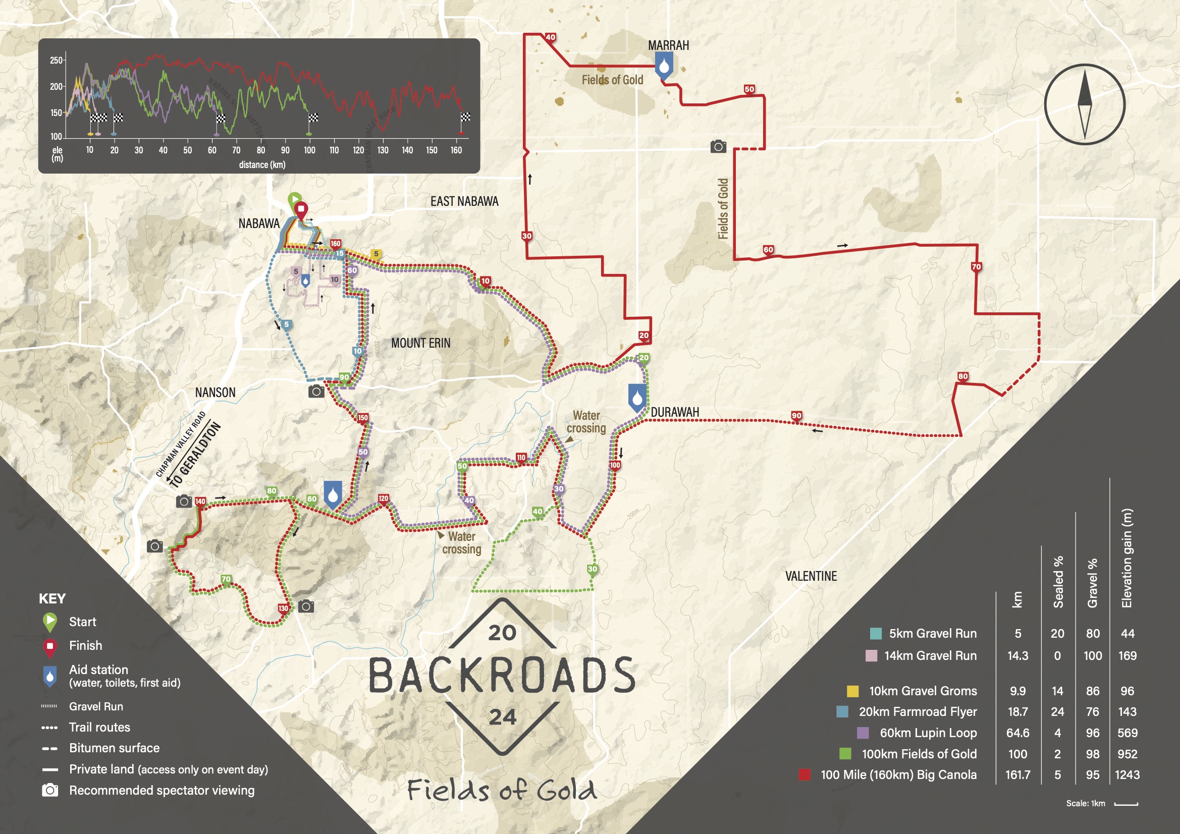
Backroads will provide riders with the opportunity to take the back road, not the main road, and gives access to a network of roads that you otherwise wouldn’t experience.
It starts and finishes in the town of Nabawa, taking riders through the undulating gravel roads within the Shire of Chapman Valley. The course route showcases the region at its finest, with blooming fields of canola crops and a glimpse of the local wildflowers. It’s a course that you would not experience anywhere else.
A special shout out to our Course Director, Roger Swan for putting these courses together and using his local knowledge to incorporate the best the region has to offer.
Courses
Course maps are now live! Scroll down to check them out. We strongly recommend that everyone download the GPX file for the event you are taking part in and load it onto your bike computer or Gramin device.
Please note these could change slightly prior to the event.
Jump to a distance
100 Mile (160km) Big Canola
100km Fields of Gold
60km Lupin Loop
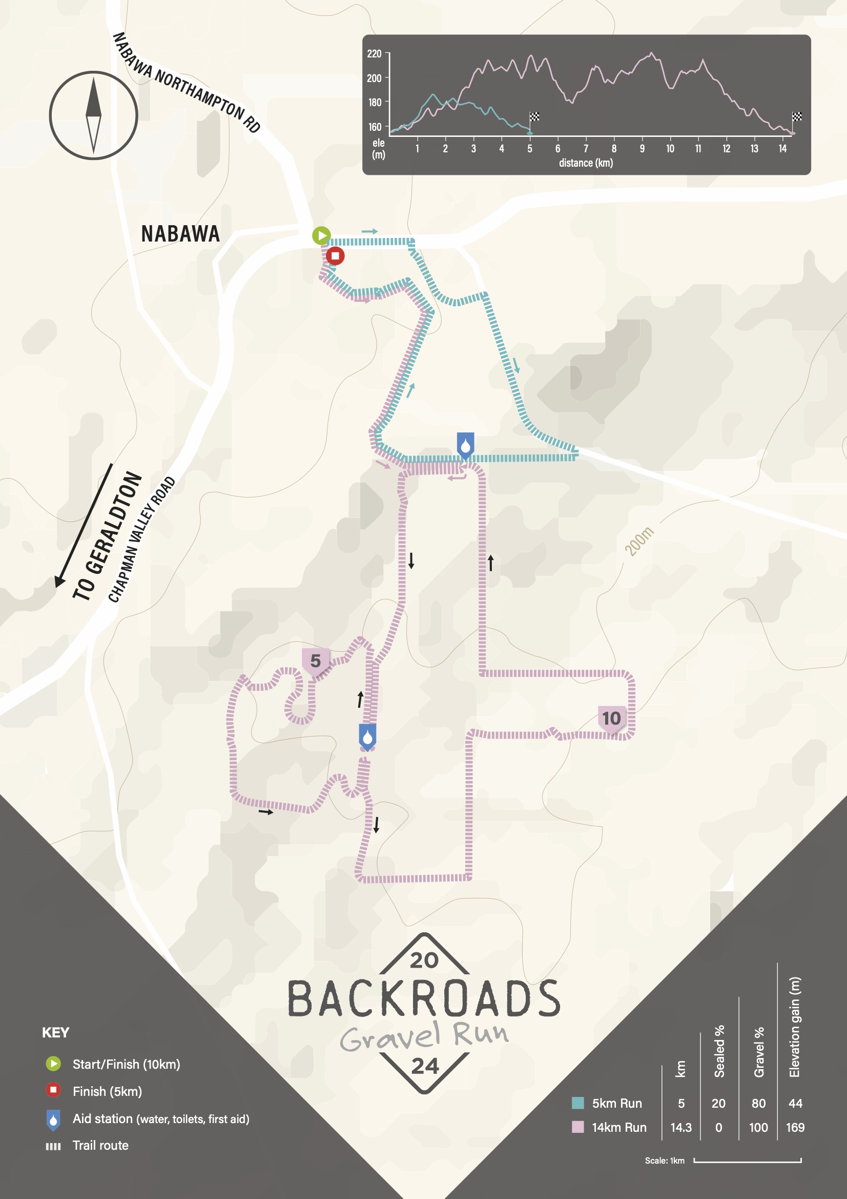
5km Gravel Run (New)
20km Farmroad Flyer
10km Gravel Groms
14km Gravel Run
PLEASE NOTE that most of the course is on private property and only accessible on event day. If you are doing a training ride prior to event day, please do not go through any gates or fences to access the course.


